In our overly modern world, some of the lost arts are at risk of fading away. Navigating by map and compass is one of them. Everyone carries their nearly-manadatory spy device with them and it very conveniently has several map and navigation apps on it. Do you know why? So that they can sell advertisers and anyone else who is interested information on your every move. Neat.
They’ve made it so convenient that you are perfectly willing to let them spy on you in exchange for easy navigation and the ability to find over-priced and low-quality coffee.

But what will you do if you are far from home and the networks go down? How will you get home? To the market to obtain food or medicine? How will you be able to map a route to Aunt Jennie’s place over the hills and through the woods?
I will instruct you and teach you in the way you should go
Psalm 32:8
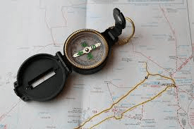
The answer is obviously to learn how to use paper maps and a compass to navigate. Navigation is more than just knowing how to use a map and how to use a compass. It’s knowing how use both of them TOGETHER to positively find your location, plan a route to follow, and then follow it using the compass.

In order to do that, you have to learn that your map, the earth, and your compass all speak a different language. The difference between true north (the earth), grid north (your map), and magnetic north (your compass) is subtle but absolutely vital. It’s like a Scottish guy talking to a Canadian, and the Canadian then telling the story to an Aussie. One of my favorite ways of describing this is telling the story of NC Scout with his NC Accent trying to talk to an Irish bartender, after both of them had been drinking. They both got to the same area, but not quite exact….you had to be there. Anyway, with my translating and a lot of pointing, Scout and I got the Orange Jameson we wanted, and Kathy said “Oh, fer fooks sake, why didn’t ya jooost say soo?”. We all laughed.
Understanding magnetic declination is exactly like that. If you plan out a route only using the map and never adjust your azimuths for declination, you will never find where you are going. The farther you go, the more important it is. Learn to use a map and compass together and then navigate. The same goes with shooting an azimuth with your compass and then trying to plot it on your map…you need to adjust it first.
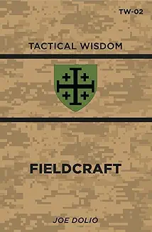
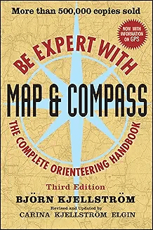
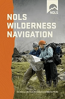
There are three great books for this, all linked below. The first, in my humble opinion, is the best: TW-02, Fieldcraft. A command sergeant major (USMC) called me to let me know it was the best explanation he’d heard. The second is Be an Expert with Map & Compass, which is where I pull my training drills from. The third is the NOLS Wilderness Navigation book. All three together make a great library.
For maps, I use http://www.mytopo.com, as they will let you build a custom topo map centered on whatever location you want. You can also buy topo maps from the USGS directly. Buy them now and have them on hand. Pick up free state maps everytime you pass a highway “Welcome Center”. Side note: Some states now require you to sign in and explain your trip to get one; it’s not illegal to lie to a rest room clerk. Another great kind of map is a DeLorme Atlas & Gazeteer. For good outdoor maps, National Geographic “adventure maps” are waterproof and tear resistant. You can find them for most of the US & Canada. GM Johnson is my favorite source for city street maps.
Topographical maps come with the declination printed on them, but for state highway maps and Atlases, you can go to magnetic-declination.com and get the declination for the center of the map and write it somewhere on the margin for future reference so that your map is always ready to use. I generally look up the declination for my destination before I go on a trip and write it in my handy notebook so that if the worst happens while I am away from home base, I have a good idea of the declination.

As far as compasses, I stick to the tried and true Cammenga Lensatic US military issue one. There are a lot of fancy compasses out there, but I haven’t found one faster in the field and on the move, ESPECIALLY AT NIGHT, than the Cammenga. The Brunton Lensatic is very close and lighter in weight, but it doesn’t have tritium. A caution for those with fancy compasses that let you adjust the declination: unless you reset it to zero after every trip, you’re going to get lost the second time you adjust it. If I adjusted it for 13 degrees west on my first trip, and my second trip is at 6 degrees east, unless I zeroed it in between, I’ll only adjust it to 7 degrees west, which is still 13 degrees from where I want to go. I just don’t adjust it – do the math instead.
Take a class and learn. This Friday, I’ll be at Mountain Readiness Fallout in Harmony, NC teaching Essentials of Land Navigation course. Next Tuesday-Thursday, land navigation is an entire day of the Fieldcraft class I’ll be teaching at the Brushbeater Training Center. As it is a physical skill, you have to get out and practice.
In addition to just navigation, learn resection and intersection. These enable you to find yourself (resection) or any point you can see (intersection) on the map.
Stop relying on technology. Start being self-reliant.
If you like this content, sign up as a monthly supporter at tacticalwisdom.locals.com or make a donation below.

Always remember Jesus loves you. Thanks for all that you do.
LikeLiked by 1 person
He does. Thank you.
LikeLike
One of my favorite topics. Best part of any military training that I ever participated in. I have a US Army lensatic compass. I have USGS topo maps. I first learned how to use a map in the 6th grade and have never lost the love of it. Then I used them hiking all over New England as a teen. Using a compass and shooting azimuths and orienteering in the Army was the pinnacle. As a home health nurse, traveling from home to home every day, I have always used paper maps. And it was imperative to have map backups even when using modern tech. Because modern tech doesn’t always work out here in the sticks. I have attempted to pass on this love to young folks that I come across in my life. Unknown if this impacted them in any way. I also always know where the compass directions are at any place. A bit harder here in New England than on the Front Range but still, I have a map in my head. It also pays to be alert to sunrise and sunset when in new surroundings.
Great topic.
LikeLike
While at a Fleet Farm, I opened the Fishing Guide maps for my state. They were a two volume set, for the northern and southern half of the state.
I was very pleased with the quality of the maps, the details of the roads and trails and land. All in I think I spent about $50.
LikeLiked by 1 person
Another good map set. Water charts.
LikeLike
I have mentioned an altimeter to you before and I still use mine when out and about. Get the analog type based on a barometer. You’ll have to reset it from time to time, but you also get the added luxury of weather forecasting. They are especially helpful in a mountainous terrain whiteout to pinpoint your location on the side of the hill. Kindest regards, Patrick
LikeLiked by 1 person
You’re not wrong. Great point.
LikeLike