So, you did your area study. You picked out your Primary, Alternate, Contingency, and Emergency Routes (PACE). You identified high risk areas and developed those routes to avoid them. You know the crime stats and all your local players. Good job.
Then, the lights went out and after three days, riots set in. It’s OK, you’ve planned for this. You got this. You load up the family into the car and head for the Primary route. A few miles down it, there is a traffic gridlock. That’s OK, your cut-over road to the Alternate is right here. You turn down it and after 2 blocks, you find out that it closed due to a bridge repair and the nieghbors are milling around your now-trapped vehicle. Congrats.
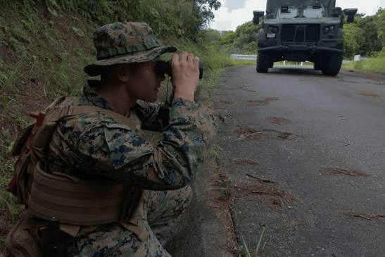
Completing your area study is not enough. Once you’ve completed it, you need to actually drive every route and validate your map recon and online research. A neighbor that looks good on paper can look totally different once you drive it in the evening. A road that appears to be good may be a wreck or under construction. You need to do what is called a route recon. Get out and drive the road and analyze it from your operational needs. Sure, the road goes where I want, but is it clear enough to navigate in the dark with my lights off if I need to? Is it so out of repair that my vehicle might be damaged or lose a tire? These are things you need to know NOW, so that you can modify your plans.

A great tool, though, for the early online research is Forward Observer’s Community S2 program. You can see detailed stats on any neighborhood in the US. You can find your nearest hospitals, fire stations, and police stations. I like the ability to see every license plate reader on the map – just in case I need to leave an area unobserved or recorded. You find their app here: https://communitys2.com/tacticalwisdom
The same goes for any safe haven’s or other areas you plan on using. You need to visit them and walk around to get a feel for it.
Recently, I traveled my planned escape route from Michigan to Montana. It travels through very remote areas, so I was driving it with an eye for how the route could facilitate travel in a complete breakdown of society. I noticed how far apart the gas stations are. When I stopped for fuel, I checked to see where the underground tank filling ports are to see if I would be able to use my siphon pump unobserved.

I scoped out and inspected potential remain overnight (RON) sites. Have you considered this? Where can you pull off and be hidden in order to sleep? In a high-stress environment, getting proper rest will be even more important. Exhaustion will give you poor decision making ability. You need to locate secure locations to rest before you actually need them.
Travel the route with scanner that has the “Close Call” feature. You need to understand the radio frequency situation everywhere you plan to drive so that your comms plan doesn’t get stepped on by some local radio group blasting out high watts on their generator-equipped repeater. You will also identify automated “SCADA” systems that are running utilities or water that could interfere with your communications if they have battery backup. Learn the RF environment.
You need to do more than just get your Area Study on paper. Once it’s completed, get out and conduct route recon and inspect the sites you plan on using. The Area Study is a working document and a living document. Revise it based on your observations and the changing environment.
Become a monthly supporter at tacticalwisdom.locals.com.


